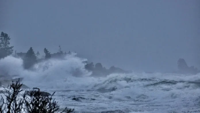

A powerful typhoon was moving toward Japan’s Pacific coast on September 21, bringing torrential rain, strong winds and an elevated risk of landslides across eastern Japan as authorities warned that conditions could worsen rapidly around the Tokyo metropolitan area.
Typhoon Dujuan had already delivered significant rainfall to parts of the country’s Pacific-facing regions, with some locations in the Izu Islands recording more than 300 millimetres of rain since Saturday. The Japan Meteorological Agency, known as the JMA, warned that heavier downpours could develop as the storm approached the Kanto region, which includes Tokyo and surrounding prefectures.
The immediate concern for authorities is a combination of intense rainfall, saturated ground and the possibility of highly concentrated rain bands. Those conditions can produce flash flooding and landslides even when the worst impacts from the centre of a typhoon remain relatively localized.
What Happened
Typhoon Dujuan was approaching the Pacific coast of Japan on Monday, September 21, with the JMA warning of violent winds, torrential rain and a growing danger of landslides in Kanto and other parts of eastern Japan.
The storm’s effects were already being felt before its closest approach to the Tokyo region. Rainfall across the Izu Islands had become particularly heavy, with some locations receiving more than 300 mm since Saturday. On Oshima, one of the islands most exposed to the storm, authorities issued the highest-level landslide emergency warning.
Oshima lies roughly 110 kilometres south of Tokyo. The island’s position means that it can receive intense rainfall from storms moving along Japan’s Pacific side, and prolonged rain increases the likelihood that already saturated slopes will become unstable.
The weather system was also affecting activities beyond emergency preparations. Organisers of the Asian Games in Aichi Prefecture postponed the equestrian eventing competition until Tuesday because of the approaching storm. Japanese Prime Minister Sanae Takaichi also delayed her planned departure for New York to attend the United Nations General Assembly because of the weather.
Why The Rain Is Such A Serious Threat
Typhoons are often associated with wind speed, but for densely populated regions such as Kanto, rainfall can be equally dangerous.
Japan’s terrain includes steep hills and mountains, while large urban populations and extensive transport networks occupy low-lying areas and river corridors. When intense rain persists over a short period, drainage systems can become overwhelmed and rivers can rise quickly.
The JMA specifically warned about the potential development of linear rain bands over Kanto and central Japan. These are narrow, persistent areas of heavy rainfall that can remain over the same location for several hours.
Their danger comes from concentration.
A broader storm can spread rainfall across a large geographical area. A linear rain band can instead repeatedly unload large volumes of water over a much smaller zone. That raises the risk of sudden flooding, slope failure and dangerous road conditions.
Reuters reported that Japanese authorities have become increasingly concerned about these rain bands in recent years because of the extraordinary amounts of rainfall they can generate over confined areas.
Tokyo Faces A Complicated Weather Risk
Tokyo’s enormous population and infrastructure make severe weather particularly consequential even when direct impacts vary from one neighbourhood to another.
A storm does not need to make a direct landfall in central Tokyo to disrupt the metropolitan area.
Heavy rainfall can affect commuter railways, roads, airports, river systems and electricity infrastructure. Flooding in one part of the metropolitan region can also cause knock-on effects elsewhere because Tokyo’s economy depends on highly interconnected transport and logistics networks.
The Kanto region includes Tokyo as well as surrounding prefectures. That means the geographical area facing heightened risk is considerably larger than the city itself.
The JMA’s warning that conditions could deteriorate rapidly is therefore significant. The most serious impacts may emerge over a relatively short period as the storm’s rain bands move into or form over populated areas.
What Residents Are Being Warned About
The immediate hazards associated with Dujuan include:
- Intense rainfall and flash flooding
- Landslides in vulnerable terrain
- Strong winds along exposed coastal areas
- Dangerous waves and coastal conditions
- Transport disruption
- Rapidly changing local conditions
Authorities have urged people to pay close attention to official weather and evacuation information rather than assuming that the most dangerous conditions will occur only when the centre of the storm passes.
That distinction matters. Rainfall-related disasters can happen before or after the point at which a storm is closest to a particular location.
A Difficult Year For Extreme Weather
Dujuan arrives during a year that has already featured significant extreme-weather events in multiple parts of the world.
Reuters noted that unusually intense rainfall, flooding and tropical cyclones have affected regions ranging from East Asia to North America and Europe in 2026.
A single storm cannot, by itself, establish a long-term climate trend. But the wider frequency and severity of extreme rainfall events are an important area of scientific and policy attention.
For emergency planners, however, the immediate issue is practical rather than statistical: how much rain will fall, where it will fall, and how quickly communities can respond.
Why The Izu Islands Matter
The Izu Islands form a chain south of Tokyo and are frequently exposed to Pacific weather systems. Their geography can amplify the consequences of heavy rain. Steep terrain means that soils and slopes can become unstable when rainfall accumulates quickly.
More than 300 mm of rainfall since Saturday demonstrates how prolonged precipitation can create danger even before a typhoon reaches its closest point. The highest-level landslide emergency warning issued for Oshima illustrates the seriousness of that accumulated rainfall.
For authorities, the task is therefore not only to track Dujuan’s centre. They must monitor rainfall totals, river conditions, slope stability and changes in the storm’s structure.
What Happens Next
The next phase will depend heavily on how close Dujuan passes to the Kanto region and how much additional rainfall accumulates. The JMA expected rainfall to intensify on Monday afternoon as the storm approached Kanto. Officials were also watching for the formation of linear rain bands that could sharply increase localized rainfall and flash-flood risk.
That means the weather situation could become more disruptive even if the typhoon’s overall track remains relatively stable.
For Japan, the priority is likely to remain damage prevention and rapid response. Local authorities will need to balance evacuation warnings, transport decisions and public safety measures against the storm’s evolving track.
The postponement of the Asian Games equestrian event shows how authorities are already adjusting plans around the weather. The delay to the prime minister’s departure for the United Nations also demonstrates that the storm has begun affecting national-level schedules. The broader picture will become clearer as Dujuan passes the Kanto area and rainfall totals are recorded.
For now, the central risk is clear: eastern Japan is facing a rapidly evolving combination of typhoon winds, exceptional rainfall and landslide danger, with Tokyo and surrounding areas preparing for the possibility of further deterioration.