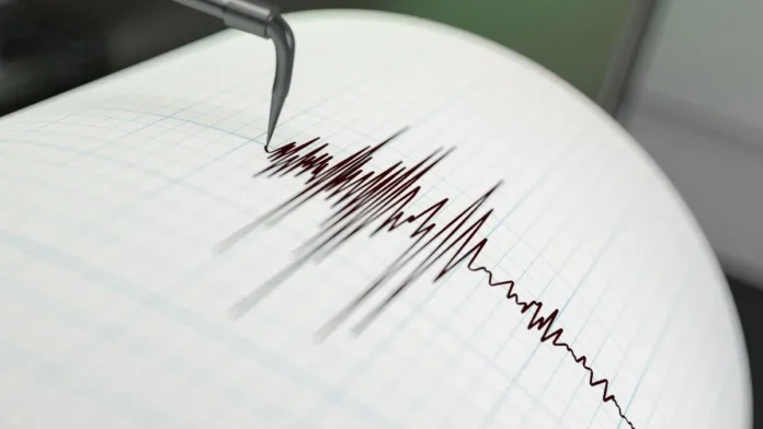

A powerful 7.3 magnitude earthquake struck the Pacific coast of Mexico’s southern state of Chiapas on Friday morning, shaking communities from southern Mexico to El Salvador, triggering an emergency tsunami warning for coastal areas, and sending thousands of people evacuating buildings in Guatemala City during the morning rush hour. Authorities in Mexico and Guatemala said there were no immediate reports of significant damage or casualties.
According to the US Geological Survey, the earthquake struck about 30 miles southwest of Aquiles Serdán in the Mexican state of Chiapas at a depth of roughly 9 miles. The tsunami warning was subsequently lifted after coastal monitoring stations recorded wave heights below the dangerous threshold. The earthquake arrives just 23 days after Venezuela’s devastating twin quakes — and comes at a moment when the Pacific coastal region’s seismic vulnerability is front of mind for emergency planners across Latin America.
What the Earthquake Measured and Where It Struck
A 7.3-magnitude earthquake struck southern Mexico and parts of Central America on Friday, seismologists said, with a tsunami alert briefly issued for a stretch of the Pacific coast. Residents felt intense tremors in the Mexican states of Chiapas and Oaxaca as well as in Guatemala and El Salvador, AFP journalists confirmed.
The United States Geological Survey said the epicentre was located 48 kilometres southwest of Aquiles Serdán, off the coast of Chiapas, at a depth of 15 kilometres. It also said the main quake was preceded by a smaller earthquake with an epicentre farther offshore.
The depth of 9-15 miles makes this a relatively shallow earthquake — a factor that significantly increases the intensity of ground shaking felt at the surface. Deep earthquakes dissipate energy before it reaches the surface; shallow earthquakes deliver their full force directly to the communities above them. At magnitude 7.3, the Chiapas quake was powerful enough to cause major structural damage in poorly built areas, though preliminary assessments suggested the submarine epicentre and the region’s relatively sparse coastal population limited the immediate impact.
The Human Experience of the Quake
In Tuxtla Gutierrez, the state capital of Chiapas, there were scenes of panic in the few tall buildings of the city, according to an AFP journalist in the area. “It feels horrible up there,” Araceli Sanchez, a government employee who was in a 15-story building, told AFP. “There were people who cried,” she added after fleeing down the emergency stairs.
In Guatemala City, the earthquake frightened residents because of how long it lasted. Many people poured into the streets in the middle of rush hour as the workday was beginning.
In Mexico City, residents reported buildings swaying, but officials said the capital’s earthquake alert system was not activated because the initial energy released by the quake did not meet the system’s warning threshold. The non-activation of Mexico City’s iconic earthquake alert system — which sounds a distinctive tone across the capital — was a source of confusion for residents who felt significant movement in tall buildings but did not receive the expected warning.
The Tsunami Warning — Issued and Lifted
The Pacific Tsunami Warning Center said: “Hazardous tsunami waves are possible for coasts located within 300 km of the earthquake epicenter,” including coastlines in southern Mexico and Guatemala, where waves could reach 3 feet (1 metre). Tsunami waves up to 1 foot (0.3 of a metre) are possible along the Pacific coasts of Colombia, Costa Rica, Ecuador, El Salvador, Honduras, Nicaragua, Panama and Peru.
The Meteorological Service of Chiapas alerted that there could be tsunami waves up to 1 metre off the coast of Mexico and Guatemala. In the town of Suchiate, located along the river that separates Mexico from Guatemala, coastal areas were being monitored for tsunami risk. The warning was subsequently lifted as coastal monitoring stations confirmed that wave heights had remained below dangerous thresholds.
Mexican President Claudia Sheinbaum said preliminary assessments showed no significant damage. The navy recommended staying away from beaches for six hours because of the risk of a tsunami.
The Geological Context — Why Chiapas Shakes
The Mexico-Guatemala border region sits above one of the most seismically active geological boundaries on Earth. The region experiences frequent earthquakes, including a powerful 7.1 magnitude quake in 2017 that killed hundreds of people in Mexico City. Earlier this year, another strong earthquake in southern and central Mexico left two people dead.
The seismic activity in this region is driven by the subduction of the Cocos tectonic plate beneath the North American and Caribbean plates — a geological process that generates both the regular earthquakes that characterise the region and the occasional tsunamigenic events that the Pacific Tsunami Warning Center monitors continuously.
The proximity of Friday’s earthquake to the site of Venezuela’s June 24 disaster — which killed more than 3,889 people and remains an active public health emergency — has heightened regional awareness of earthquake risk. Mexico’s earthquake alert system, the Seismic Alert System or SAAS, is one of the world’s first and most sophisticated early warning networks, providing up to 60 seconds of advance warning to Mexico City for earthquakes originating on the Pacific coast. Its non-activation on Friday — because the initial energy release was below the system’s threshold — will be reviewed by Mexican seismologists as part of the standard post-event assessment.
What the Aftershock Risk Looks Like
There were at least 10 aftershocks between magnitude 4.9 and 6, according to USGS. The sequence of aftershocks following a 7.3 magnitude mainshock typically continues for days to weeks, with the largest aftershocks potentially capable of causing additional damage to structures already weakened by the mainshock.
Mexican President Claudia Sheinbaum said she had spoken to the governors of the affected states, while Navy Secretary Raymundo Morales told reporters: “There are no serious effects.” Emergency response protocols have been activated across Chiapas and Oaxaca, with building inspectors dispatched to assess infrastructure for possible damage before residents return to evacuated buildings.
The absence of major casualties on Friday reflects both the offshore location of the epicentre and the effectiveness of Mexico’s building standards in major urban areas, which have been progressively strengthened following the devastating 1985 and 2017 earthquakes. The memory of those disasters — and the SAAS alert system they helped to create — gives Mexico City a level of seismic preparedness that is rare globally and that has saved thousands of lives in subsequent events.